After the 8.8 magnitude earthquake on the Richter scale that occurred off the coasts of Russia and Kapon on Tuesday, July 29, 2025, it seems that social awareness has once again recalled the devastating and dangerous effects of these natural phenomena. This tremor seems to have remained just that, with the chances of a tsunami decreasing more and more. However, on its part, the United States has received a warning of a possible megatsunami due to the movement of the Cascadia Fault, on the west coast of North America.
As the Proceedings of the National Academy of Sciences, this subduction zone extends from the north of Vancouver Island, Canada, to Cape Mendocino in California. According to geologist Tina Duro, there is a 15% chance of the fault breaking in the next 50 years. To understand the behavior of these phenomena, the scientist has focused on past events such as the 400-meter tsunami on the Hawaiian island of Lanai 105,000 years ago, or going back to 1700, when the last movement of the Cascadia Fault caused a major earthquake in the Pacific region, triggering a tsunami in Japan.
Volcanic eruptions, earthquakes, and tsunamis
Any kind of large-scale atmospheric phenomenon is terrifying for those affected. Many times the consequences are irreparable, both at a structural level and physically or emotionally. The case of volcanic eruptions, earthquakes, or tsunamis are three of the most devastating and feared phenomena. But, how are the dreaded waves that can wipe out entire communities produced? It is usually due to two exclusive factors: the tremor caused by a volcanic eruption, or the tremor caused by the displacement of a fault in an area of tectonic plate activity. This displacement causes a tremor in the earth, followed by the generation of waves of increasingly larger size and height.
Cascadia Subduction Zone
The Cascadia Subduction Zone is an underwater geological fault. According to data from a recent study published in the Proceedings of the National Academy of Sciences, this fault extends from the northern part of Vancouver Island in Canada to Cape Mendocino in California. Thanks to the study led by geologist Tina Duro, the rise in sea level produced in that area has been studied, outlining the dangers it could pose, especially regarding flood risks.
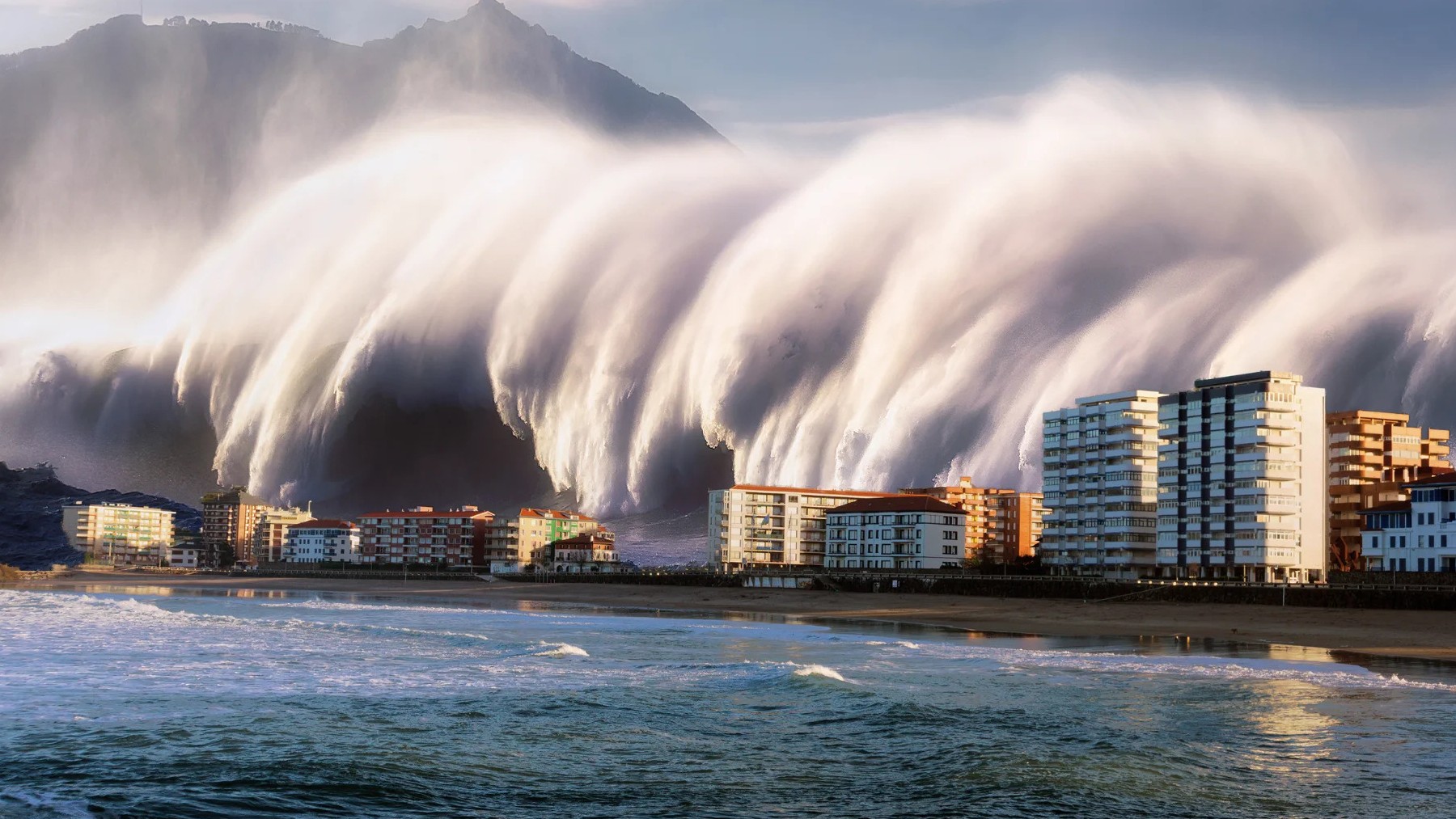
15% chance of tsunami in the United States
The study conducted by Duro has reached conclusions that have alerted the American population. According to the study, the probability of a rupture in the Cascadia fault zone is expected to be 15% in the next 50 years, generating a megatsunami of 300 meters that would hit the west coast of the United States. Exponentially, the probability percentage increases to 29% by 2100. Tina Duro explains it this way: “With rising sea levels, the immediate effect of earthquake-induced subsidence will be a delay in response and recovery due to compromised infrastructure. In the long term, it could make many coastal communities uninhabitable”.
Study the past to understand the present
Duro and his team have focused on studying past events to understand and predict the behavior of present events. In this way, they aim to have a better forecast of the damages that could occur in the northeast of the Pacific. One of the techniques used is to study marine sediments, through which they were able to determine that a 400-meter tsunami occurred on the island of Lanai in Hawaii, 105,000 years ago. However, this event shows differences as it is a land movement of volcanic origin.
This is why, to obtain more realistic and comparable data, we would have to go back to 1700, when the last movement of the plates in the Cascadia Subduction Zone occurred. What happened? This movement caused an earthquake of between 8.7 and 9.2 on the Richter scale that struck the west coast as far as the shores of Japan across the Pacific Ocean.
Did you know that earthquakes caused the destruction of half of the Roman Coliseum?